Polling Stations
Kalpetta Assembly had over 110 polling stations, many subdivided into multiple wings to serve rural and hill villages. Examples include:
- Vivekodaya Lower Primary School, Puthusseri (Left and Right wings)
- Moon Light LPS, Mundakutty (multiple wings)
- Government High School Kurumbala (several blocks)
- Serve India Adivasi LPS, Kuppadithara
- Aided UPS and Govt HSS blocks in Padinharethara
- Multiple schools & community halls in Thariode, Vengappally, Kaniyambetta, Padinjarathara, Meppadi and Vythiri
These are distributed across plateau towns, tea-and-coffee plantations, tribal settlements, and forest-fringe wards.
Geographic & Demographic Traits
Kalpetta sits at an altitude of ~780 m on the Wayanad Plateau, surrounded by lush coffee and spice estates. It functions as Wayanad’s hub along NH‑766, linking Kozhikode and Mysore, and also intersects Kerala’s proposed Hill Highway SH‑59 through Meppadi. The municipality population stood at ~31,580 in 2011, with literacy exceeding 90% and a robust gender balance.
Economy & Livelihood
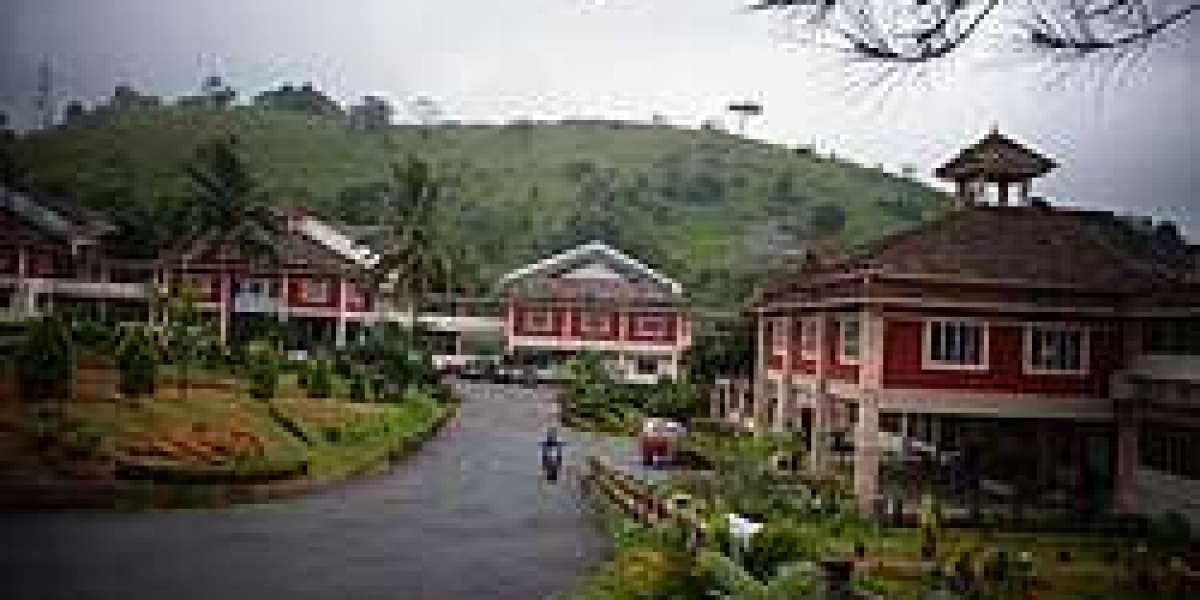
- Tourism & hospitality: Kalpetta hosts the densest concentration of resorts and homestays in Wayanad, spurred by eco-tourism and hill-station visits.
- Agro-industry & plantations: Surrounding panchayats produce coffee, tea, spices, pepper, rubber and vegetables. The Milma Wayanad dairy at Chuzhali processes over 1 lakh litres of milk daily for regional markets.
- Trade & retail: As Wayanad’s banking hub, Kalpetta supports 21 scheduled bank branches, fruit and vegetable markets (tracked by VFPCK), and growing urban retail chains.
- Remittance income: Many families depend on Gulf earnings, although less dominant than coastal seats.
- Education & public services: The municipality houses district institutions, teacher training centres, and administrative offices providing employment.
Socio-economic Strata
A large segment of residents belong to the middle-income bracket, bolstered by tourism earnings, plantation profits, retail trade, and public service jobs. The higher-income tier includes resort owners, traders, and plantation entrepreneurs. Some remote tribal settlements in panchayats like Padinharethara and Vythiri face below-poverty-line vulnerabilities, though literacy and government welfare schemes are raising community well‑being.
Recent Developments
- In response to the 2024 Mundakkai–Chooralmala landslide, the government has begun building a 64‑hectare rehabilitation township at Elston Estate near Kalpetta, with model homes underway.
- Road upgrades on NH‑766, state highways, and forestry roads around Meppadi and Muttil are underway, improving connectivity and tourism access.
- The expanding Kinfra mini industry park, dairy infrastructure, and public service modernization are boosting local employment.
Kalpetta Assembly Constituency is a vibrant hub tying together tourism, agriculture, trade, and plateau administration. With a largely middle-class electorate and structured developmental momentum—from landslide rehabilitation to infrastructure and ecology-driven tourism—Kalpetta is evolving as a gateway for sustainable growth across Wayanad’s highland region.